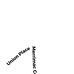
300-302R MERRIMAC ST
Owner Information
LAGOULIS JAMES TRS
79 STATE ST
NEWBURYPORT, MA 01950


Property Details
300-302R MERRIMAC ST is classified as a Marinas - including marine terminals & associated areas primarily for recreational marine craft (not Ch. 61B) (Clubs/lodges).
The primary structure on this property was built in 1996. There are 4,680ft2 of built area within this property. There is 2,640ft2 of residential/living space within this property.
300-302R MERRIMAC ST is valued at $3,654,700. The land is valued at $2,613,000 and the structures are valued at $274,500. There is an additional valuation of $767,200 on this property.
This property is in Zone WMD. Confirm with local Zoning Board authorities to ensure there are no overlays or other easements on this property.
300-302R MERRIMAC ST was last sold on Tuesday, September 24, 2019 for $0.
Assessment data from fiscal year 2021.
Flood Data
This property is partially within the AE Zone (within floodplain). Approximately 3.44 acres (60.88%) of the property is within this zone.
The base flood elevation for this flood zone is 8 feet.
This information is sourced from the FEMA National Flood Hazard Layer. See our full disclamer.
Broadband Internet Providers
| Provider | Type | Bandwidth (mbps) | |
|---|---|---|---|
| Verizon New England Inc. | DSL | 10 | 1 |
| Viasat Inc | Satellite | 100 | 3 |
| Comcast | Cable | 1000 | 35 |
| T-Mobile | Fixed Wireless | 25 | 3 |
| GCI Communication Corp. | Satellite | 0 | 0 |
| HughesNet | Satellite | 25 | 3 |
| VSAT Systems, LLC. | Satellite | 2 | 1 |
Broadband service provider data from December 2020.
Adjacent Properties
- 3 WOODLAND ST
Potentially Developable Residential Land owned by MCCURDY JOSEPH A - 2 WOODLAND ST REAR
MARINA 00 MDL-00 owned by LAGOULIS JAMES TRS - 300-302 MERRIMAC ST
Other, Open Space owned by CONDO MAIN - 300 MERRIMAC ST
CONDO MDL-05 owned by ISABEL MARTINE M - 302 MERRIMAC ST
CONDO MDL-05 owned by ROTONDI CHARLES D - 298 MERRIMAC ST
Two-Family Residential owned by BROWN JOSEPH S - 294 MERRIMAC ST
SFR WATER MDL-01 owned by SWEETALL JOY M - 304 MERRIMAC ST
Other, Open Space owned by CONDO MAIN - 304 MERRIMAC ST UNIT 1
CONDO MDL-05 owned by PORTANOVA PATRICIA - 304 MERRIMAC ST UNIT 2
CONDO MDL-05 owned by CARLETON KERRI - 304 MERRIMAC ST UNIT 3
CONDO MDL-05 owned by FISHER CHERYL TRUSTEE - 308 MERRIMAC ST
Single Family Residential owned by PALAZZO MARY L